


.jpg)


.jpg)
.jpg)
.jpg)

.jpg)


.jpg)


.jpg)

.jpg)
_Cropped.jpg)
.jpg)


.jpg)
.jpg)


.jpg)
.jpg)


.jpg)

.jpg)


.jpg)


.png)


.jpg)
.jpg)
.jpg)
.jpg)
.jpg)
.jpg)
.JPG)
.jpg)
.jpg)
.jpg)

.jpg)

Interviewed via E-Mail
July 3, 2013
Matthew Andrews, CA+T Interviewer
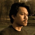
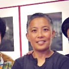
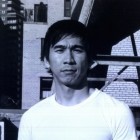
Lordy Rodriguez, Artist
Matthew Andrews: How did you get started in art (e.g., as a child, in school)?
Lordy Rodriguez: I started with art as a kid in third grade. I remember the moment specifically. Our [US] class was paired with our sister class in Russia. Both classes were charged with drawing the shape of our respective countries from memory. The Russian kids, naturally, almost all of them got the general shape of their country. We, on the other hand, did not. That really stuck with me and probably was the very first foray into drawing and into drawing maps. I feel like I am spending the rest of my life proving that I really know the shape of America, which is ironic since I have never used the actual shape of America in my work. But what really fostered my art education was going to the High School for the Performing and Visual Arts in Houston, Texas. There, not only did I learn my craft, I really started to think of art as a conceptual exercise rather than an aesthetic one since the art department at that school focused more on conceptual concerns. Actually the Junior level art classes are called “Conceptual Concerns.”
MA: How did you become interested in maps and cartography?
LR: This body of work really started in undergraduate school at the SVA [School of Visual Arts] in N[ew] Y[ork]. I would drive back and forth between Houston and New York at the end of every semester. Back then there weren’t any G.P.S. [devices], so I was constantly looking at maps, the AAA maps in particular. But it wasn’t until I started to feel homesick for Texas that I started to look at the map differently. Instead of using it as a tool, I would look at my maps as places of longing. Kind of like the way we look at Google Earth. You would do a search of where your house is, maybe where you work, or the place you grew up. One night, feeling very homesick, I drew in my journal a made-up map of New York with a symbol where my school was, and I drew Houston as a suburb. I would imagine that I would live at home, still have all my high school friends close by, and still only drive an hour to get to SVA. It was the only way, besides going back home, to quell my feeling of homesickness.
MA: How did you come up with the idea of your pieces, North Pole and South Pole?
LR: One of the reasons why I work so much with the map of the US is because I have such a close attachment to this country. The land both influences us and we influence it. The poles on the other hand are interesting because they are two masses that we have a direct influence (global warming etc), yet most of us have no idea or relation to the actual landscape. Being able to work with the poles is a way to play with that relationship to land that differs from [our relationship with] other land masses that we are more familiar with. I've done three different versions on the poles so far, and each new version plays with different aspects of the poles.
MA: One theme in your work is the remaking and redrawing of boundaries, whether it is adding states or even inventing lands. Could you speak about this?
LR: Maps are very ingrained in our general psyche to physically describe a place. A landscape can be so recognizable, like for example the shape of America, to the point where you wouldn’t even need text to tell you that what you are looking at is America. Look at a world map—let’s say the Mercator projection—and most people would be able to recognize what they are looking at. Now take that same globe, and turn it so Antarctica is facing you: all of a sudden the globe doesn’t look all that familiar. Turn a map of America on its side or upside down, and that recognizable factor is lost a little. That slight change in context changes the way we read the map. This is a quality in that semiotic system that deems the map language, along with any other visual language, malleable depending on the context in which the visuals are provided. I've always conditioned my way of appropriation through the guise of appropriating the visual language of maps rather than the actual image of maps. This affords me the ability to address almost any subject, especially one not related to cartography, within the map language without having to be limited by preconceived notions of the land. So, essentially, by not conforming to actual country shapes, I can distill basic tropes of familiarity through language which I think has a more wider critical scope.
MA: What inspires you and why?
LR: All visual languages. From the visual language of maps to the visual language of corporate branding, fashion, TV, etc. Visual languages do not have a grammatical structure that we would find in spoken or written language. But they do have a structure. Some languages are more apparent in the structure, like advertising. But I think for me, figuring out that structure, understanding those semiotic systems, and looking for ways to manipulate those systems are what inspire me for new work. Often, I’m looking for similarities in the structure of differing visual languages in the hopes of finding maybe a universal structure that all visual languages may adhere to. But no matter which language I am using, they are all "told" through the established structure of cartography. Using cartography as a "grammatical" backbone, I am able to find different ways to use and understand differing visual languages.